In the early months of 2025, Australia was a land of dramatic water stories.
As devastating floods lashed Queensland’s tropical north, causing widespread destruction, that very same water began a slow, transformative journey south. Months later, and a thousand kilometres away, a separate storm system unleashed a rapid deluge upon the coast of New South Wales.
The European Space Agency’s Sentinel satellites provided an unparalleled view, demonstrating how different technologies are essential for understanding our planet’s extremes.
The Source: Queensland’s Torrential Rains
The story of Lake Eyre’s 2025 filling begins not in the desert, but in Queensland’s tropical north. From January through April, a series of tropical lows stalled over the state, unleashing cyclonic-level rainfall that inundated towns like Townsville and Ingham. The Herbert River swelled to historic levels, the Bruce Highway was severed, and thousands were evacuated.
This immense volume of water, after causing devastation in the coastal regions, flowed inland, entering the vast network of rivers and creeks known as the Channel Country. This was the start of a life-giving pulse, a slow-moving flood that would travel for months across the arid landscape.
The Destination: A Desert Oasis for Sentinel-2
As the Queensland floodwaters meandered south, they headed for the continent’s lowest point: the vast, usually dry salt pan of Kati Thanda-Lake Eyre. Here, under the clear outback skies, the Sentinel-3 satellite (among other Earth Observation satellites) was the perfect tool to document the unfolding miracle. Its high-resolution optical sensors captured the vibrant transformation in stunning detail.
This timelapse was recorded between early May and mid-June and chronicles this incredible event. What began as a trickle into the northern edge of the lake in early May evolved into a sprawling inland sea. The images show the water’s methodical advance, pushing south over 120 kilometres to fill Madigan Gulf and Belt Bay. This spectacular filling, potentially the largest since 1974, triggered an ecological explosion. Dormant brine shrimp hatched, fish carried by the rivers populated the new lake, and millions of migratory waterbirds flocked to the sudden oasis.
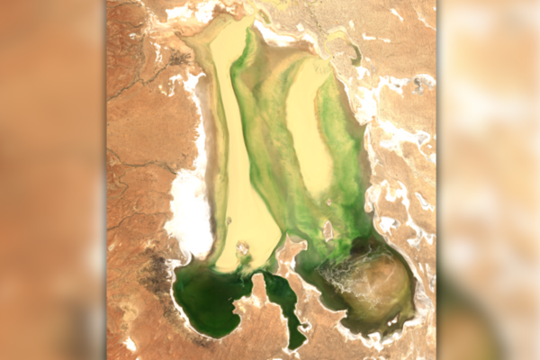 Kati Thanda-Lake Eyre in far north South Australia, taken by ESA Sentinel-2 on Sunday, 25 May 2025
Meanwhile, in May, a completely different weather system slammed the NSW Mid North Coast. A slow-moving low-pressure trough unleashed a rapid, catastrophic deluge on the Hunter Valley, a 1-in-500-year event that swamped towns like Taree.
Amidst the storm, persistent cloud cover rendered optical satellites like Sentinel-2 blind. This is where its counterpart, Sentinel-1, became indispensable. Using Synthetic Aperture Radar (SAR), which can see through clouds and at night, provided critical, all-weather intelligence. Before-and-after imagery delineated the full extent of the floodwaters. In the aftermath, it tracked the water’s recession.
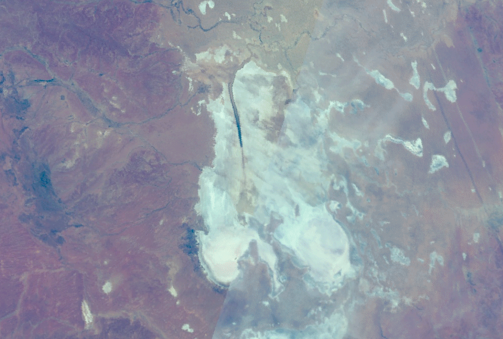 Kati Thanda-Lake Eyre in far north South Australia, taken by ESA Sentinel-3 from 5 May to 16 June 2025
 South West Rocks in New South Wales, taken by ESA Sentinel-3 on Wednesday, 21 May 2025
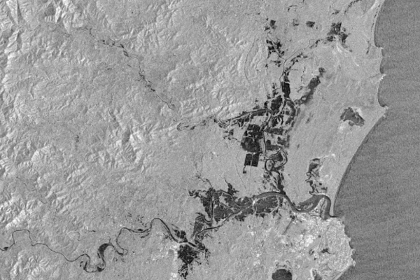 Port Macquarie in New South Wales, taken by ESA Sentinel-3 on Wednesday, 21 May 2025
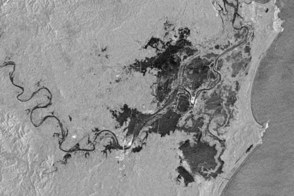
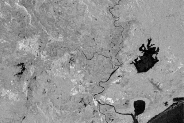 Newcastle in New South Wales, taken by ESA Sentinel-3, 14 May to 2 June 2025
Together, these satellites and the events they monitored tell a powerful story. Sentinel-3 patiently documented a beautiful, slow-motion rebirth fuelled by distant floods. In stark contrast, Sentinel-1 provided an essential, real-time lifeline during a sudden coastal disaster.
These satellites are perfectly equipped to capture both the tragedy and the wonder of water in a land of extremes.
Fabrice Marre
Senior Earth Observation Specialist