The South Australian Government’s investment in Kanyini as capacity building exercise for the state’s space industry has provided a unique opportunity for research and innovation.
SmartSat CRC has developed and is now managing a diverse portfolio of projects that leverage Kanyini as an on-orbit experimental platform for both onboard AI applications and advanced downstream data analytics.
Innovative Demonstrations and Applications
Several innovative applications are currently in development for deployment on Kanyini, demonstrating the satellite’s potential to deliver real-world impact. This includes a near-real-time smoke detection system, developed by University of South Australia and Swinburne University of Technology, that will use AI-driven image processing to help the SA Country Fire Service detect smoke faster, improving fire management and emergency response. Meanwhile, downstream, researchers at the University of Adelaide and University of Queensland, are working to enhance SA Water’s seagrass monitoring efforts by using Kanyini’s wide-area, high-temporal imagery to gain a more comprehensive view of water ecosystem health. Urban heat island mapping, previously reliant on infrequent aerial sensing, will be expanded with Kanyini’s thermal imaging, allowing SA Department of Environment and Water (SA DEW) and Green Adelaide to extend their monitoring efforts to remote communities that were previously excluded (Flinders University). Additionally, a team at University of Adelaide is leveraging Kanyini’s hyperspectral imaging to enhance ecological and land-use management across South Australia, supporting SA Department of Primary Industries (PIRSA) and SA DEW environmental stewardship and policymaking.
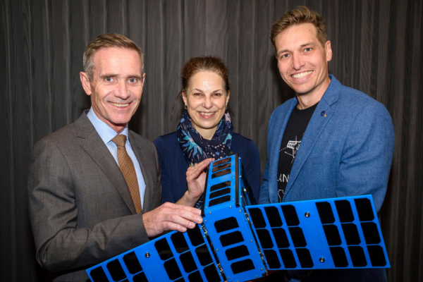 SmartSat Chief Research Officer, Dr Carl Seubert (right) with Dr Davina White (centre), GIS Lead for South Australian Department of Primary Industries and Regions representing the SAEcoMap project, and Defence SA Chief Executive, Matt Opie (left).
A Sovereign Space Asset for Prioritised Tasking
Besides being an excellent test platform that matures technology, Kanyini offers the ability to learn the intricacies of operating and tasking imagery of relevant sites. Having our own Earth Observation (EO) asset has allowed the team to prioritise and collect a thermal imagery of Adelaide during the recent heatwave events, which will prove a vital set of data for that research team. Similar tasking aligned to in-situ sensing and field campaigns has already been achieved.
Building a Case for Sustained Space Investment
With these collaborative research projects SmartSat is advancing analytics and data processing capabilities to transform EO imagery into actionable intelligence for tangible societal, environmental and economic benefits to South Australians and the nation. This SmartSat funding in innovative research is a key value add to the SA investment in the EO space asset and develops fundamental technical capabilities in the state to build an experienced smart space nation.
These projects illustrate the tangible benefits of investing in space-enabled technology R&D and reinforce the need for continued cross-sector collaboration.
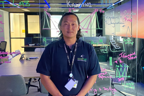 SmartSat’s Onboard AI Engineer, Andrew Du, in the SCARLET Lab at SmartSat HQ.
Next Steps for Kanyini
The Kanyini engineering team is currently working through commissioning of the imaging payload, focusing on system checkouts and calibration and validation. As the satellite moves into full operational capacity, we will be able to increase tasking frequency and optimise image capture for research applications. In parallel with these efforts, SmartSat Onboard AI Engineer, Andrew Du is conducting onboard AI testing at SmartSat’s SCARLET Lab, preparing technology experimentation in spacecraft autonomy and AI-driven processing.
With these exciting developments, Kanyini is showcasing Australia’s capability in a dedicated EO asset and driving innovative research that benefits our environment, economy, and future policy decisions.
Stay tuned for more updates as we unlock the full potential of this mission!
Dr Carl Seubert
Chief Research Officer
Feature image: A Principal Component Analysis (PCA) of the Coorong and Long Bay in South Australia, taken by SA Space Services Mission satellite, Kanyini.