SmartSat’s Scarlet Lab is helping young data and computer science students break into the space industry by providing hands-on experience in Earth Observation, Artificial Intelligence (AI), and Machine Learning (ML).
The Scarlet Lab projects, in collaboration with the University of South Australia, offer master’s students the opportunity to apply the knowledge gained during their postgraduate program while gaining real-world, industry experience through the completion of a capstone project.
The current project group, all of whom are completing a master’s in computer science through the University of South Australia (Uni SA), are investigating the use of ML techniques to classify smoke and fire activity within freely available satellite imagery. These ML techniques are then evaluated to determine their accuracy and performance criteria.
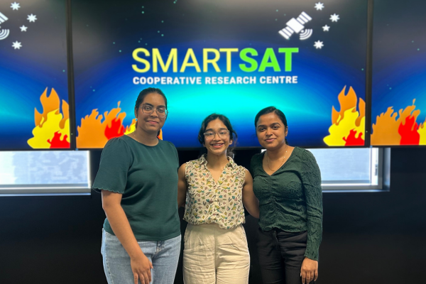 (L-R) Master’s students Harshitha Annapureddy, Anisha Abraham and Ishana Thrivi in the Scarlet Lab at SmartSat HQ.
The current student group brings the number of students to complete capstone projects through the Scarlet Lab to 28. Previous groups have looked at using similar ML techniques to look at cloud segmentation and the identification of native vegetation.
“All of the students have only ever worked with textural or numerical data. These projects expose them for the first time to another form of data – imagery gathered from satellites. The student’s skills in data manipulation and coding are challenged and expanded during their research when comparing different ML algorithms.”
Donna is currently completing her own SmartSat-funded PhD research quantifying dieback of eucalypt forests using remote sensing.
“I use remote sensing tools for Earth Observation as part of my research to understand eucalypt forest health, focussing on dieback locations and occurrences,” Donna said.
“As a mentor, I have been able to introduce data scientists into the space industry, helping them understand why Earth Observation is an exciting field and a potential career path where they can apply their data analysis skills.”
Harshitha Annapureddy has a background in computer science and engineering, including programming, algorithm design, and statistical modelling. Her previous work on other data-driven projects, predictive modelling and visualization tools has fuelled her passion for using innovative technologies to solve real-world problems.
“The idea of applying satellite imagery for fire and smoke detection immediately caught my interest because of its huge real-world impact. Bushfires are a major environmental and safety concern, and being able to contribute to a solution that enhances early detection and disaster response is incredibly rewarding,” said Harshitha.
“Collaborating with SmartSat and the Scarlet Lab is an incredible opportunity to work at the intersection of AI and space technology, learning from experts and gaining exposure to real-world industry applications.”
Anisha Abraham has a decade of experience specialising in Computer Science, completing a Bachelor of Technology and working in the ICT industry before pursuing her masters. Over the years, Anisha has worked on a range of impactful research projects, including developing a customized data visualization tool to improve hospital efficiency and patient management, using ML to detect Medicare fraud and analysing Spotify streaming trends.
“I’m really excited to be part of the smoke and fire detection project through the SmartSat Scarlet Lab, especially with the recent launch of Kanyini, Australia’s first state-owned satellite,” Anisha said.
“The Kanyini Smoke Detection project, led by Dr Stefan Peters at Uni SA, is a key initiative for SmartSat as it directly contributes to advancing the capabilities of Kanyini in environmental monitoring and disaster management.
“Given the devastating wildfires of 2019, improving fire detection and response strategies has never been more urgent, and I’m proud to be contributing through this capstone project to helping Dr Peter’s team mitigate such disasters in the future.”
Ishana Thrivi has a strong background in data analysis, having completed her Bachelor of Science Computer Science, Mathematics, Statistics and working on a number of projects involving predictive models, socioeconomic data analysis, and clustering algorithms for detecting data anomalies.
“This project aligned well with my data science skill set, allowing me to apply what I’ve learned in areas like image classification, remote sensing, and predictive modelling, while also learning more about the growing role of AI in environmental sustainability,” Ishana said.
“The opportunity to work with SmartSat CRC, a leading organization in Australia’s space technology ecosystem, and be part of the Scarlet Lab meant I could gain experience in applying ML to satellite data – an area I’ve been wanting to explore.”
“Wildfire detection is not just a technical challenge but also an environmental and societal one. Contributing to a solution that could support early detection and disaster management felt meaningful to me.”
Shivani Shah completed the Scarlet Lab capstone project as part of her Masters of Data and Computer Science in 2024. Her team, who were working on native vegetation classification, even won “Most Outstanding Poster for a Post-Graduate Professional Capstone Project” at Uni SA’s Enterprising STEM Expo.
“The chance to contribute to solving a real-world problem in satellite image analysis was both exciting and challenging,” Shivani said.
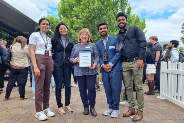 The previous Scarlet Lab Master’s student group Reyna Roy, Shivani Shah, Donna Fitzgerald, Avinash Prem Chand and Arun Menon after winning Most outstanding Poster at the University of South Australia 2024 STEM Expo.
“The program not only enhanced my technical skills but also helped me develop a deeper understanding of research methodologies and industry applications. I am incredibly grateful for the opportunity to work on a live problem, gaining hands-on experience that has significantly contributed to my professional growth.”
“It provided a unique opportunity to work on an industry-driven research project within an actual company environment, allowing me to engage with professionals from the CEO to research team members.”
Since completing her Master of Data and Computer Science, Shivani has joined the SmartSat team full time as a Research Software Engineer, supporting the Scarlet -ɑ project and the broader portfolio of Scarlet Lab initiatives. Shivani credits the program for exposing her to the space industry and allowing her to transition into her current role at SmartSat.
“The industry connections, technical expertise, and problem-solving mindset I obtained have been invaluable in shaping my career,” she said.
As an alumnus of the program, Shivani wants to encourage the current cohort to work together, support each other, believe in themselves and their work, and to make the most out of the opportunity.
“My biggest advice is to hold this opportunity to the fullest. This program is a gateway to hands-on industry experience, and it is up to you to make the most of it,” Shivani said.
“This program is not just about learning technical skills; it’s about developing problem-solving abilities, leadership, and a mindset that will serve you throughout your career. Go all in, and you will come out stronger and more prepared for your future.”
After completing my master’s in data science, I plan to continue deepening my expertise in machine learning and data science, ideally in a role where I can apply my skills to projects that can make a real difference in people’s lives, especially in areas like environmental monitoring, disaster management, and healthcare. I’m passionate about contributing to solutions that tackle complex problems and improve the well-being of communities. Whether it’s advancing technology for better disaster response or improving healthcare systems, I want my work to have a lasting positive impact.
Aside from technical growth, I’m hoping to gain [from this project] a deeper understanding of how satellite technology can be applied to solve environmental problems, especially in the context of Australia’s bushfire risks.
I’m also looking to improve in areas like interdisciplinary collaboration, where data science intersects with environmental science, remote sensing, and emergency services. This project is teaching me how to communicate technical findings to stakeholders – a skill that’s essential in any applied research setting. I also hope to gain confidence in driving a project from idea to outcome, while learning how to navigate research challenges with resilience and adaptability.
One of the biggest challenges [of this project] will be handling large-scale satellite data efficiently, as working with high-resolution geospatial imagery requires significant computational power and data processing techniques. Another challenge is achieving high detection accuracy, as factors like cloud cover and atmospheric conditions can make it difficult to distinguish smoke from other elements.
Choosing and fine-tuning the best ML models for the job will be key, as balancing accuracy, computational efficiency, and real-world applicability is essential to making the system practical for end users, such as emergency services and researchers.