From the time a bushfire ignites, every minute counts when it comes to managing its spread and minimising its destruction. Satellites are able to spot the early signs that a fire has started, however the conventional process is slow. The satellite must take, process and send full size, data rich images to a ground station on earth for processing, all before any fires can be properly detected and warnings issued.
By the time an alert reaches emergency services through this current process, valuable time has been lost. This matters for Australia, one of the most fire-prone countries on Earth. Additionally, small satellites can only send limited amounts of data to the ground at any one time, making the use of large, detailed images slow and costly to transmit.
In order to close this gap, a project team led by Dr Stefan Peters from Adelaide University (formerly the University of South Australia) built SmokeScout, an Artificial Intelligence (AI) system that detects the presence of smoke directly on board the satellite, instead of waiting for images to be delivered and processed on the ground. Rather than sending large image files, the satellite transmits a small alert that indicates where the smoke is, how confident the system is, and a simple, low data map of the affected area.
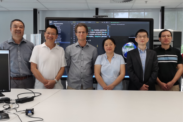 (L-R) Associate Professor Xixue Liu, Professor Jiuyong Li, Dr Stefan Peters, and Dr Sha Lu from Adelaide University with Professor Kai Qin and Dr Yu Sun from Swinburne University of Technology
SmartSat CRC investment brought together a team of researchers from Adelaide University, Swinburne University of Technology, and US-based space infrastructure company, Loft Orbital, building a unique Australian capability in onboard satellite AI for fire smoke detection.
“Detecting bushfire smoke on board the satellite lets us turn an observation into an alert in near real time, instead of waiting for images to be processed on the ground,” said Dr Stefan Peters.
“With SmartSat CRC’s support, we’ve shown that a small, efficient AI model running in orbit can match much larger systems, and that opens a real path to faster fire warnings for Australia.”
The project advanced through a series of phases. Originally, the team developed and tested their AI model on the ground with the intent of demonstrating it on the Kanyini CubeSat mission, although that spacecraft suffered a failure in early 2026 making it unusable for that demonstration.
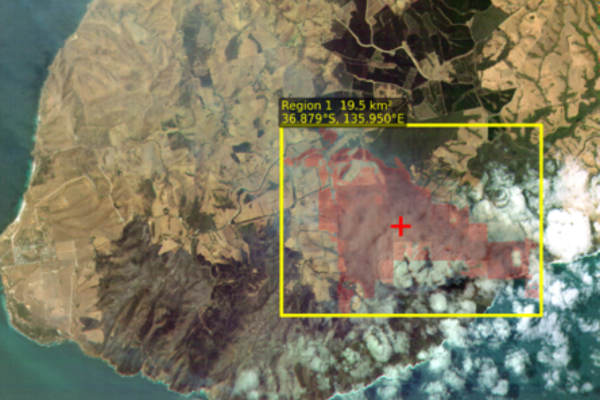 The figure shows a YAM6 scene with the SmokeScout alarm output overlaid. The yellow box delineates the detected alarm region, covering approximately 19.5 km², and the red cross indicates the estimated alarm centroid. The red shaded area highlights the high-confidence predicted smoke region. Together, these overlays provide a focused visualization of the region responsible for triggering the onboard alarm.
Subsequently, the research team got the opportunity to deploy their model in space on a compute payload aboard the International Space Station giving some good experience in deploying such model in the context of an operational space mission, although that deployment did not have an onboard imager to generate model inputs.
As a final demonstration the model was deployed onboard Loft Orbital’s YAM-6 satellite in mid-June 2026. With SmartSat CRC’s support, the team was able to calibrate the hyperspectral sensor on YAM6 so the raw readings could be turned into reliable measurements; an essential step for ensuring trustworthy results. As a final demonstration the model was deployed onboard Loft Orbital’s YAM-6 satellite in mid-June 2026.
The key breakthrough of the project was making the AI model both accurate and tiny. SmokeScout learns from simple “smoke or no smoke” labels rather than costly, hand-drawn outlines, yet it matches the accuracy of far larger systems while the onboard model inference runs in under a third of a second on a basic onboard processor. So far, the team has captured 30 YAM-6 images overactive wildfires, 15 of them cloud-free with clear smoke patterns used for model training. The key lesson: compact, energy-efficient AI can do work once thought to need powerful hardware.
Geoscience Australia has identified the results as directly useful for improving its Digital Earth Australia Hotspots service, a national bushfire monitoring system relied on by emergency services. By employing the SmokeScout model, state and territory fire and forestry services would gain earlier, more precise alerts delivered straight from orbit of fires before they have a chance to grow and spread.
Because the model enables the sending of compact alerts instead of full images, it uses only a fraction of the usual data, providing a real advantage for the many small satellites that increasingly make up Australia’s space fleet. The project also delivered a labelled smoke-image dataset and reusable tools for other missions.
The deployment onboard Loft Orbital’s YAM-6 satellite is the first full demonstration in a larger plan. Between July and September 2026, the team will task YAM-6 to watch real wildfires, test SmokeScout onboard in order to demonstrate the complete observation-to-alert system to emergency services, fire agencies, government and industry. The results will also be presented at the Advancing Earth Observation Forum in Hobart in November 2026.
This same approach towards onboard processing and AI powered systems can be adapted to other satellites and sensors, as well as to new uses such as monitoring crop health, water quality and biosecurity. The research team is also refining the model in orbit as more real fire images are collected.