There is a moment, standing inside the NSW Rural Fire Service State Operations Centre in Sydney, when the scale of what Australia asks of its fire services hits you physically. Wall-to-wall screens. Hundreds of data feeds. An 80-million-hectare jurisdiction where a single missed ignition can become a national catastrophe. It sets the right frame for a day spent thinking about what space technology can and cannot yet do for the people managing Australia’s fire risk.
Our SmartSat CRC delegation (comprising myself, Chief Research Officer Dr Carl Seubert, and CEO Professor Andy Koronios) was in Sydney for the XPRIZE Wildfire Finals Testing Event, and the Rural Fire Service (RFS) State Operations Centre tour was a fitting place to start.
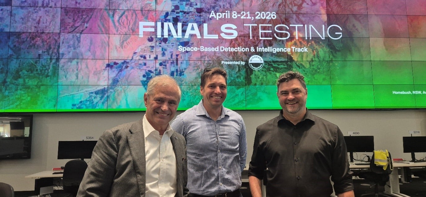 SmartSat CEO Professor Andy Koronios, Chief Research Officer Dr Carl Seubert, and Senior Earth Observation Specialist Fabrice Marre at the XPRIZE Wildfire Finals Testing Event in Sydney, NSW
We were there for the XPRIZE Wildfire Finals Testing Event, the culmination of the $11 million competition’s Track A: Space-Based Fire Detection. Eight finalist teams from around the world, twelve days of live testing against real Australian bushfires, and a single, brutally simple question: can you detect a 10-metre fire from space within sixty seconds?
SmartSat CRC has skin in this game. We have been supporting the Redback Fire Team, led by Professor Simon Jones’ team at RMIT University and built on 25 years of physics-based fire science. We are also connected to the SIRIUS Wildfire Alliance through our partnership with Linlin Ge from the University of New South Wales (UNSW). Being in the room was not a spectator sport. It was a chance to see years of research and development collide with the realities of operational firefighting, and to witness firsthand where space technology adoption stands up, and where it stumbles.
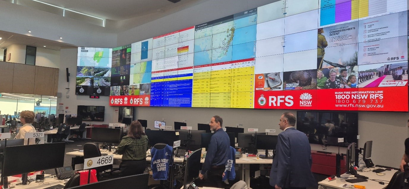 NSW Rural Fire Service State Operations Centre
The event opened with a frank briefing from NSW RFS Deputy Commissioner Peter McKechnie, who did not mince words. The devastating Black Summer fires of 2019-2020 shattered the assumption that traditional methods such as human spotters, phone calls, and slow data chains could keep pace with Australia’s escalating fire risk. The RFS wants what Peter called a “building alarm for the bush”; an automated, space-based detection system that provides early, accurate, and high-confidence alerts without requiring a helicopter dispatch just to confirm whether a fire is real.
That last point, the false positive problem, dominated every conversation throughout the day. When you are responsible for 80 million hectares, a system that cries wolf is worse than no system at all. Every false alarm drains aviation fuel, exhausts crews, and leaves actual communities exposed. The message from the fire chiefs was unambiguous: we will not adopt technology we cannot trust.
Eight Teams, One Burning Question
What struck me most about the finalist teams is how wide the technological spectrum they represent actually is, from deeply empirical physical science at one end to cutting-edge artificial intelligence (AI) at the other, with genuine innovation at every point in between.
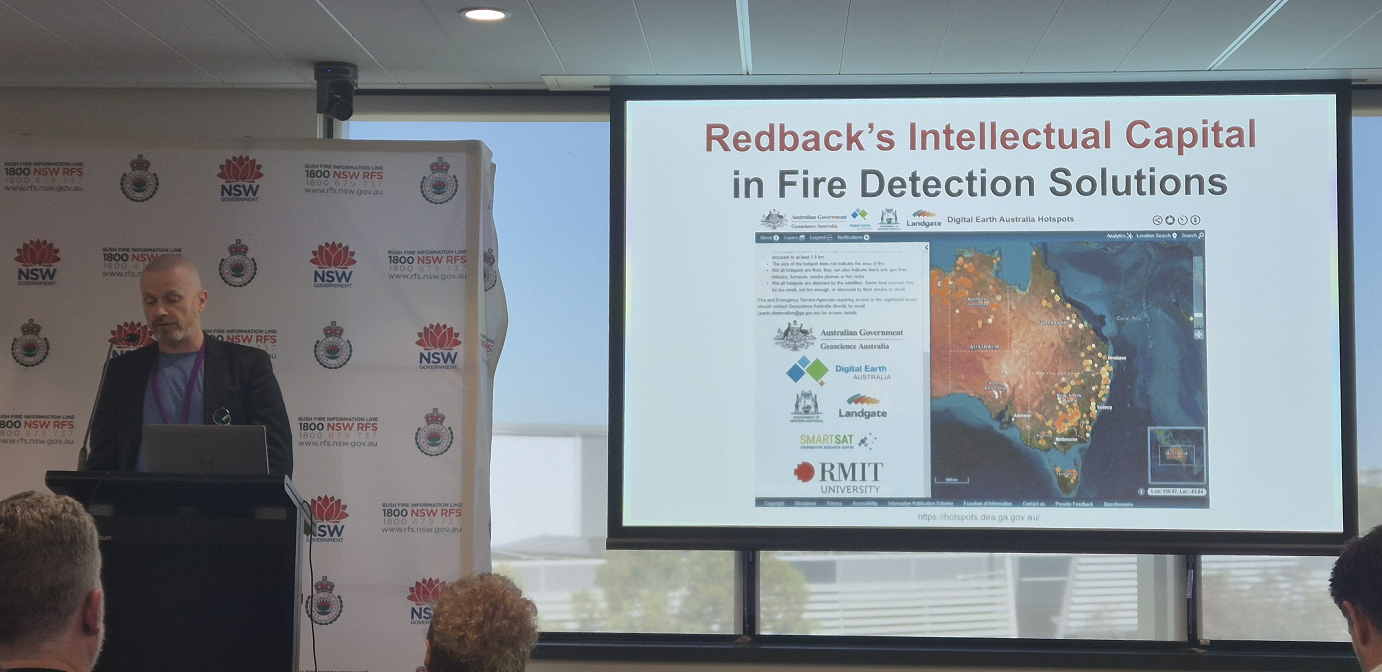 Professor Simon Jones from RMIT University presenting the Redback Fire team solution
At the physics-based end, the Redback Fire team led by Professor Simon Jones (a seasoned expert in wildfire detection and behaviour modelling) calculates what the thermal emission of every geographic pixel should be on any given day based on a 28-day historical baseline, flagging anomalies against that expected value. Their companion Inferno model uses the Rothermel fire-spread equation to generate isochrone predictions, clear rings showing where the fire will be in one, two, and three hours. It is transparent and scientifically rigorous, which matters when a fire chief needs to understand why the system is recommending an evacuation.
The SIRIUS Wildfire Alliance, another team with strong Australian ties, structures its platform around a ‘fire triangle’ of detection, forecasting, and operations, built by an international coalition spanning the Imperial College London, UNSW Sydney, UK startup Pine Peak, and Italian frontline firefighting professionals. SmartSat CRC has supported some of Professor Linlin Ge’s Earth Observation research at UNSW, and his expertise in satellite-based disaster response runs through SIRIUS’s detection architecture.
Their standout feature is an interactive tactical simulator. A fire manager draws a proposed containment line on the map and within 90 seconds the system simulates not just whether the fire will be stopped, but whether embers will fly over the break given the prevailing wind conditions, allowing commanders to test strategies digitally before committing crews to the ground.
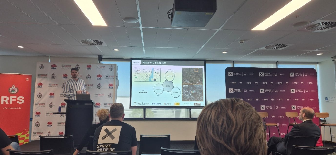 Dr Daniel Fredrich from the Imperial College London presenting the SIRIUS Wildfire solution
Moving along the spectrum, hybrid platforms like MyRadar and Team Snuft fuse physical environmental science, weather indices, topography, and fuel flammability with machine learning to filter false positives and rank fires by urgency rather than just size. At the far end, fully AI-driven teams like DeepFire, Haven AI, and Mayday AI rely on convolutional neural networks, generative AI, and autonomous agents to pattern-match anomalies across massive satellite datasets, largely bypassing hard-coded physics in favour of deep learning.
Critically, none of this matters if it doesn’t work in the field. The XPRIZE tests against live bushfires and controlled burns in the Australian landscape, at which point theoretical potential is stripped away quickly. Whether a system is powered by thermodynamic equations or the latest generative AI, the judges are looking at one thing – does it detect a 10-metre ignition within sixty seconds and characterise its behaviour within ten minutes?
The team presentations were impressive, but it was the panel discussions, first at the RFS venue and later over dinner at Taronga Zoo’s Gili Rooftop, that crystallised the real challenge. As one panellist put it, “creating the technology is only ten percent of the battle. Integrating it into a high-stakes, legacy operational environment is the other ninety”. This framing resonated deeply with those of us working at SmartSat CRC and now building the Australasian Space Innovation Institute (ASII). ASII was established precisely to bridge this gap, connecting end-users with industry and universities to translate research into impact. The adoption barriers the panellists described are not unique to fire, however. They mirror the challenges we encounter across agriculture in Australia.
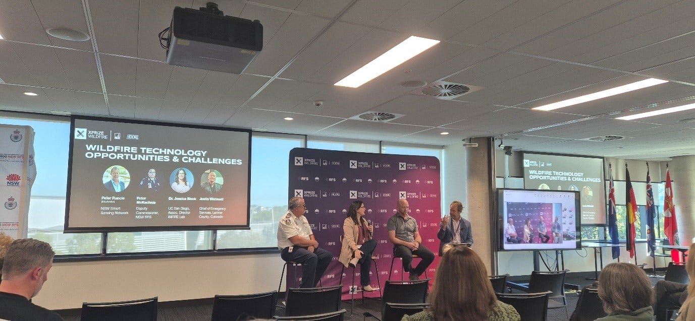 Panel discussion with Natural Hazards & Smart Places Theme Leader at NSSN, Peter Runcie; Deputy Commissioner Strategic Capability at the NSW Rural Fire Service, Peter McKechnie; Associate Director of WIFIRE Lab at UC San Diego, Dr Jessica Block; and Chief of Emergency Services at the Larimer County Sherrif’s Office in Colorado, Justin Whitesell.
The false positive trap
Fire commanders will not adopt a system that forces them to verify every alert with a helicopter. The technology must deliver high-confidence, actionable intelligence, not raw thermal imagery that requires a data scientist to interpret. This is identical to the challenge facing agricultural Earth Observation. For years, AgTech companies sold farmers raw NDVI maps and wondered why adoption stalled. Farmers do not want coloured pixels; they wanted a proposed prescription telling them how much nitrogen to apply to which paddock tomorrow morning. The lesson here is universal – hide the math, deliver the decision.
Justin Whitesell, Chief of Emergency Services at the Larimer County Sherrif’s Office, Colorado, described the reality of waking up to a massive uncontained fire. A commander does not need an app showing 500 red dots. They need a system that tells them where the fire will be in two hours so they can deploy resources and order evacuations. The technology must reduce cognitive load for exhausted responders operating on little sleep, not add to it.
Fire agencies already use established Computer-Aided Dispatch systems. If a new tool requires a commander to log into a separate website or pick up a different tablet, it will fail. The technology must feed directly via the application programming interface (API) into existing systems using standard emergency symbology. No new screens. This is the number one complaint in Australian agriculture too, with farmers drowning in disconnected apps for their tractor, weather station, and drone and it is a problem ASII’s flagship programs are explicitly designed to address through Digital Twin approaches.
Fire technology must work even when cell towers have burned down. Agricultural technology must work in the cellular black spots of outback Australia. Both demand edge computing and low-bandwidth satellite uplinks.
The procurement valley of death.
Government procurement cycles can take two to three years. Most startups will run out of venture capital and go bankrupt waiting for a fire department to sign a purchase order. The clear consensus of the panel was that to survive, innovators must find dual-use commercial markets. If a satellite can detect a fire near a power line within two minutes, a utility company will pay for that data to prevent liability. Insurance companies will pay for early warnings to mitigate payouts. This commercial revenue sustains the company while enabling it to serve government at a subsidised rate, exactly the model championed by Mayday AI and precisely the kind of commercial translation pathway that ASII aims to accelerate.
The Evening debate: Hardware, data, and the future of the constellation
As the sun set over Sydney Harbour and our group settled into cocktails on the Taronga Zoo rooftop, a second panel brought the competing teams together for a more pointed debate. The question of how to solve space-based detection split the room.
 Sydney sunset view from Taronga Zoo’s Gili Rooftop
Professor Simon Jones from Redback argued firmly for investing in high-quality hardware rather than cluttering orbit with cheap micro-satellites. MyRadar’s Sarvesh Garimella countered that their planned constellation of 140–150 LEO micro-satellites could be deployed for under $20 million. DeepFire’s Supratik Mukhopadhyay proposed a lateral move entirely, High-Altitude Pseudo-Satellites (HAPS), cheap solar-powered drones that loiter in the stratosphere for months. Andrea Giusti from the SIRIUS Alliance raised what may be the most important non-hardware issue of all, data hoarding. Plenty of satellites are already capturing valuable fire-relevant data, he argued, but it is locked behind proprietary walls. The industry must embrace open data sharing to fight a global threat.
This debate encapsulates the strategic questions ASII will need to navigate as it shapes Australia’s space-enabled disaster resilience program. Our work through SmartSat has demonstrated that the BRIGHT algorithm, running on existing Himawari-8 geostationary satellite data, can deliver hotspot notifications across Australia in under 10 minutes. That capability was built not by launching a new constellation, but by developing smarter algorithms for data that already exists. The future likely demands both: sovereign sensor assets where gaps are critical, and open, interoperable data frameworks that maximise the value of every pixel already being captured.
 Sydney night view from Taronga Zoo’s Gili Rooftop
What this means for ASII and the Australia’s space sector
Walking out of Taronga Zoo that evening, three things were clear. First, the XPRIZE has proven that the underlying technology works. Locally developed algorithms are detecting real fires, from space, in real time, against live bushfires in the harsh Australian landscape. This is not hypothetical. It is happening now. Second, the gap between a working algorithm and an adopted operational tool remains vast and it is primarily a problem of trust, integration, and commercial sustainability, not physics. Closing that gap requires exactly the kind of neutral, end-user-connected innovation ecosystem that ASII is being built to provide. Our flagship program on Digital Infrastructure for Disaster Management is not an abstract policy aspiration; it is a direct response to the needs articulated by fire chiefs, agricultural producers, and emergency managers across the country.
Third, Australia has a genuine competitive advantage in this space. We have the fire problem, the research depth, the operational partnerships with agencies like NSW RFS, and through ASII, a national vehicle for translating space research into fielded capability. The Redback team’s BRIGHT algorithm, SmartSat’s portfolio of EO projects, our SAR-based all-weather bushfire monitoring research, and the cross-institutional collaboration with universities and space agencies represent a portfolio of capability that few countries can match.
The XPRIZE will announce its winners soon, but to reach the real prize – a trusted, validated, operationally integrated space-based fire detection system that saves Australian lives – will take a longer race. It is one that ASII, and the broader Australian space and Earth Observation community, is well positioned to run.
Fabrice Marre
Senior Earth Observation Specialist