The launch of the new clean room facility at the Edith Cowan University School of Engineering marked a significant step forward for Western Australia’s emerging space and defence industry, establishing sovereign satellite development capability in the state.
The facility, developed through a partnership between Edith Cowan University, LatConnect 60 (LC60) and the Western Australian Government, has been purpose-built for the assembly and integration of Low Earth Orbit (LEO) satellites and advanced optical payloads. Speakers at the launch described the project as a major milestone for Western Australia’s growing role in the national space sector, with future satellite launches already planned aboard SpaceX missions.
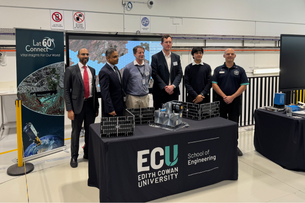 Representatives from LatConnect 60 (LC60) and Edith Cowan University at the opening of the new clean room facility.
Edith Cowan University Vice-Chancellor, Professor Clare Pollock, said the clean room would become a hub for innovation, giving students the opportunity to work on real-world aerospace and advanced manufacturing challenges while contributing to the development of WA’s defence and space ecosystem. She highlighted the facility as an example of successful collaboration between universities and industry to build sovereign capability in critical technologies.
Western Australian Minister for Defence Industry, Ms Caitlin Collins MLA, said the project demonstrated the value of government, university and industry partnerships in diversifying the state’s economy and building advanced technology capability. The WA Government supported this project through a $3.5 million Investment Attraction Fund contribution in 2024, matched by LC60. Collins noted the increasing importance of Earth Observation technologies for sectors including agriculture, emergency management and environmental monitoring.
Edith Cowan University Deputy Vice-Chancellor Research, Professor Paulo de Souza, said the partnership with LC60 had been ‘jointly developed’ rather than operating as a conventional university facility leased to industry. The clean room is designed as a Class 1000 facility, with the ability to operate at Class 100 standard if required, enabling integration of sensitive optical payloads and satellite electronics.
Professor de Souza also highlighted international collaborations underway through the facility, including work with NASA’s Marshall Space Flight Center on short-wave infrared (SWIR) bushfire detection technologies.
LC60 founder, Venkat Pillay, outlined the company’s long-term ambition to build between 50 and 100 satellites in Western Australia, drawing inspiration from the growth trajectory of US satellite intelligence company HawkEye 360. Pillay said LC60 was focused on applications spanning food security, environmental monitoring, defence and national security.
The company is currently developing two SWIR satellites with support from the WA Government and the Australian Space Agency. Potential applications include methane and CO2 monitoring, crop health analysis, early missile warning systems and high-resolution environmental observation. Pillay also referenced increasing global interest in missile detection and strategic surveillance technologies amid current geopolitical tensions.
Dr Reuben Rajasingam said Deloitte forecasts the Asia-Pacific Earth Observation market to reach USD$315 billion by 2030. He argued that current market growth is constrained by fragmented supply chains, with LC60 pursuing a vertically integrated model combining satellite infrastructure, data access and AI-driven analytics.
Central to this strategy is LC60’s EONet60 platform, which integrates more than 100 different data types into a unified operational picture using AI-enabled fusion technologies. The system has already supported emergency response activities, including rapid disaster imaging during Cyclone Narelle in collaboration with Landgate and WA’s Department of Fire and Emergency Services, achieving operational image turnaround times of approximately 90 minutes. LC60 is also collaborating with Synspective to analyse flood peak levels using comparative satellite imagery and working with rice growers in Malaysia on crop health prediction systems.
Dr Rajasingam identified a global market gap in high-resolution SWIR capability, noting that while visible-spectrum, synthetic aperture radar and thermal imaging markets are relatively mature, commercial high-resolution SWIR data remains extremely limited. Current plans include a phased satellite deployment roadmap beginning with two satellites, followed by constellations of nine and eventually 18 spacecraft.
Speakers throughout the event emphasised the importance of sovereign infrastructure, trusted data pathways and Australian-controlled analytics capability as the nation expands its role in Earth Observation, emergency response and defence-related space technologies.